North Fork Whiskers Draw Ruins
22 September
A series of alcove dwelling sites in the north fork of Whiskers Draw, a tributary of Cottonwood Creek. This site is not well known, and though a dirt road passes nearby, it is far from obvious there's a canyon to the south, much less a set of ruins. Not far from here--in this same canyon--is the alcove in which Richard Wetherill discovered, in 1893, the remains of 97 Basketmaker people who had been massacred more than 1500 years before. This was one of the most important archaeological discoveries in the whole southwest, but the location of this alcove, which Wetherill had called "cave 7," was lost, and it remained unknown until 1990, when archaeologists painstakingly exploring every alcove in Whiskers Draw finally rediscovered it.
German photographer Steffen Synnatschke found this ruin and put a very lovely photo of it in his "Secrets of the West" portfolio.
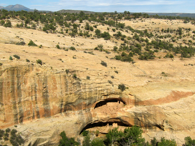
At the head of the canyon is this "two-story" alcove containing well-preserved structures on both levels. Access into the canyon is about a quarter-mile down-canyon from here.

A closer look from above reveals some of the detail of the site. Several of the upper structures and one of the lower are very well preserved. There were perhaps a dozen or more rooms in this little village, as well as a kiva.
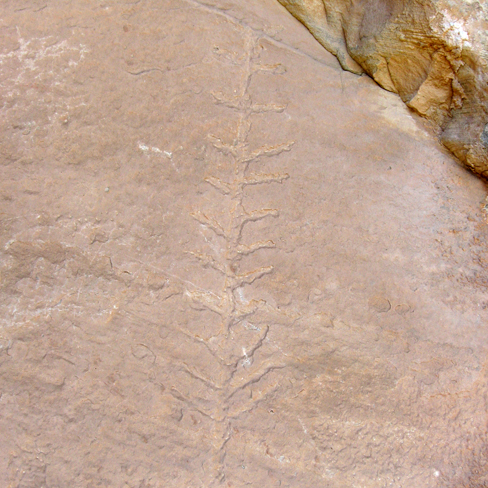
You pass by a couple of other dwelling sites as you walk up-canyon from the easiest entrance point. These are unremarkable except for a few specifics, such as this petroglyph depicting what is probably a corn plant.
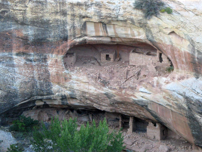
A lush forest grows at the head of the canyon below the stacked alcoves containing the cliff dwellings. In this photo, you can see the upper alcove and one of its outer walls. The lower alcove, hidden behind the vegetation, is still a ways above the canyon floor.
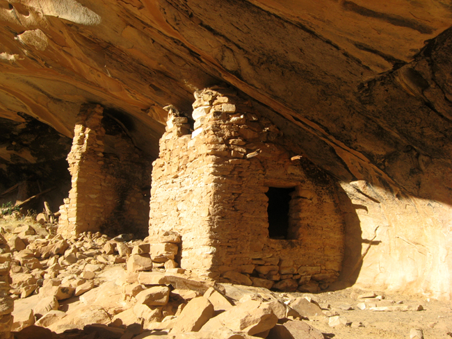
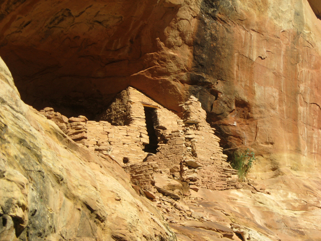
This is the best-preserved structure in the lower alcove.
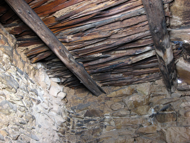
The most notable aspect of this structure is its nearly perfect ceiling and roof. The "attic" of the structure was probably a granary.
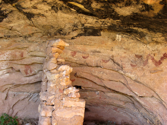
The site has numerous petroglyphs and pictographs. Here you can see a positive hand-print, a negative hand-print, several crescent-shaped thingies, and the end of a bold zig-zag.
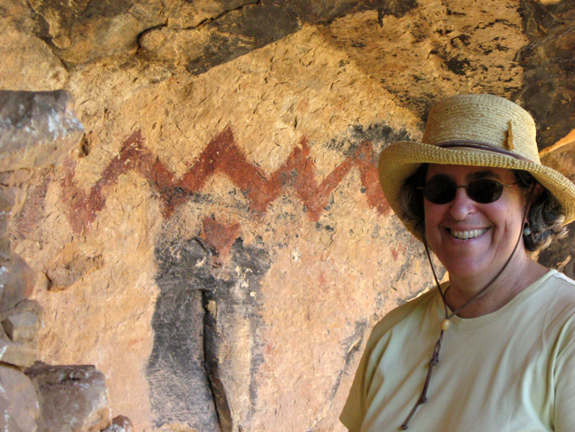
The zig-zag is actually pretty large and striking.
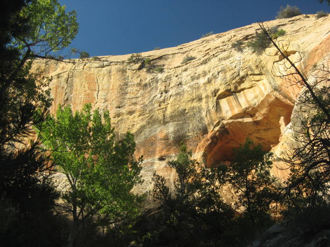
From a sloped ledge just up-canyon from the lower alcove, the upper alcove with its very nice structures is tantalizingly close. But it would take a long ladder or expert rock-climbing skills and rope to get up to it. You can see, however, that the structures were more than one deep. When the site was inhabited, it must have been rather impressive.
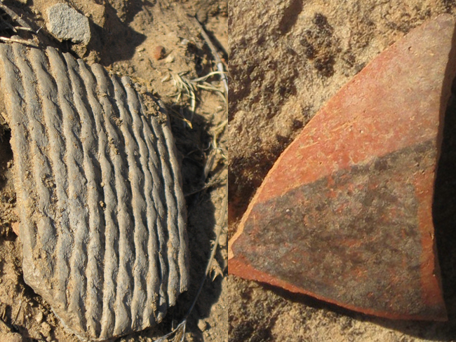
The midden below the site seems to have quite a bit of material in it, suggesting a reasonably long period of habitation. There are many pottery shards on the surface, and you can easily find more by moving a little soil with your foot. The shard on the left is from a piece of coiled utility-ware, used every day for cooking, carrying water, or storing food. The shard on the right is from a much less common black-on-red pot that may have been made far to the south and traded for.