Lewis Lodge
23 September
Location-wise, Lewis Lodge is the one of the most spectacular ruins in the southwest. And with 44 rooms, granaries, and kivas, its one of the largest in this region. It wasn't discovered until 1956, and since then it has been studied fairly well. Access has remained difficult, however, and as a result few people visit it. There's a visitor log at the ruin, and over a three-year period no more than 100 or so parties have signed in. But we didn't know any of this when we decided to try to find the spot marked "cliff dwelling" on the non-topographic Forest Service map of the area!
To read what Forest Service archaeologists say about this site, look at this photo of the information sheet provided for visitors.
)
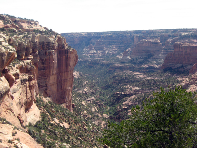
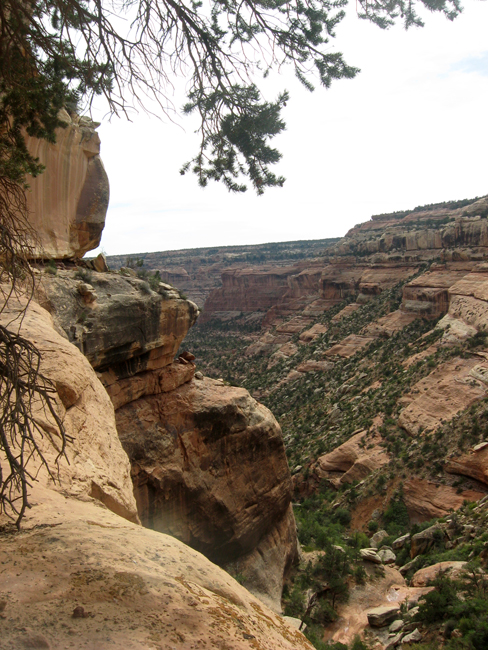
We parked at a spot along the road that seemed close to the symbol on the map and headed off in the general direction of the side canyon we knew lay ahead. There seemed to be be something of a trail, and we followed it. After a mile or so, and one tricky climb down steeply inclined slickrock, we arrived at the head of the side canyon. Everything in front of us dropped away precipitously.

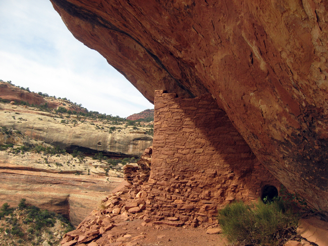
We walked along the west rim a bit. From there we could see numerous structures over on the east side of the canyon (look under the jutting piece of rock to the left of center). It was clearly a sizeable and interesting ruin, but it looked completely inaccessible.
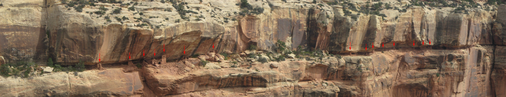
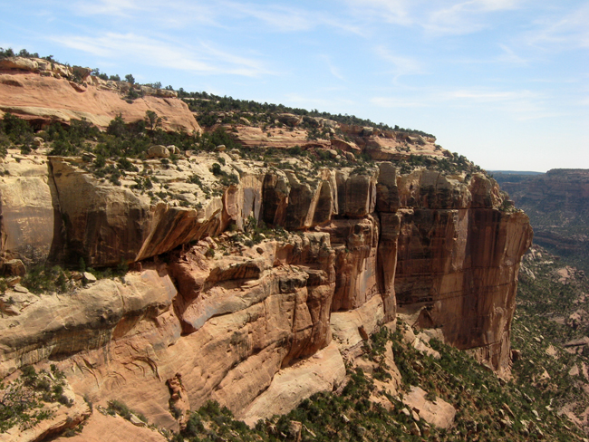
From a spot a bit further along on the west rim, we could see that the same ledge across on the other side was packed with structures for perhaps a hundred yards. Damn! A super-cool ruin but no way to get to it.
Exploring along the edge of the cliff, however, we found a way down. It was a little exposed, but not too difficult. It led down to a ledge under the west rim that also had Anasazi structures. At various points along the ledge, water seeped out from cracks--a reliable source of water for the residents of this village.
It turned out you could walk along this ledge all the way around the head of the canyon--under a vertical dry fall that hid the ledge from view above. This is the view of the east side of the ledge after rounding the canyon head.
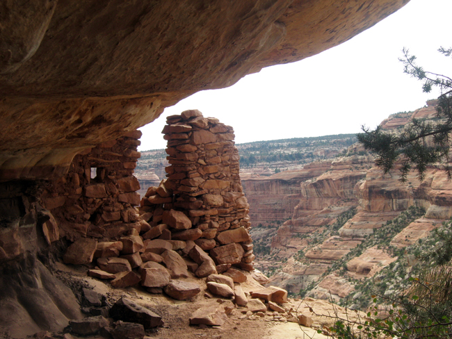
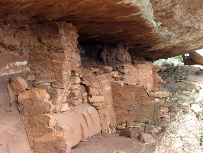
First you get to this gateway wall. It was likely a defensive structure--a place to lie in wait for intruders and attack them from a protected position. Notice the loop hole to the left of the doorway. Through this orifice and another just below, sentries could see anyone approaching on the ledge.
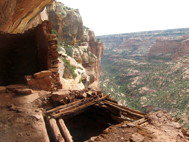
Not far beyond the gateway wall is the ruin's largest set of structures: a two-story tower, a kiva, another large room, and some smaller rooms, all connected together. Here you can see the doorway down into the kiva and its very well-preserved roof, as well as part of the tower. This was probably the center of the village. The flat roof of the kiva made a nice little plaza.
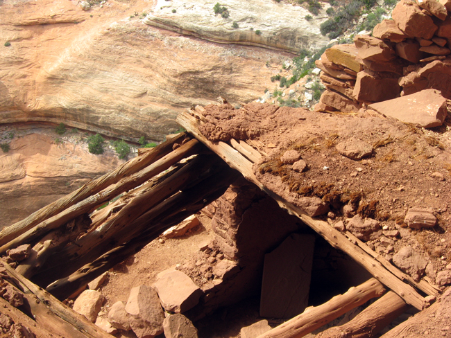
Here is a closer view of the kiva's entrance. When it was in use, the kiva extended a couple of feet further out toward the canyon. The part of the wall supporting that portion has fallen away. You can see here the fibrous juniper bark used to as a base for the hard-packed clay of the plaza floor.
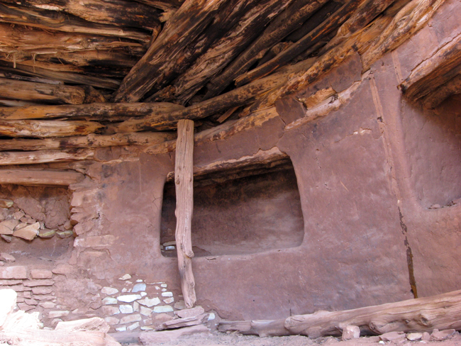
The interior of the kiva is in remarkably good condition. Most of the walls still have their layer of clay stucco, and the vestibules are whole. You can see in this photo how the ceiling was constructed out of cribbed logs.
This is what the tower looks like from the far side. When the kiva was whole, it went all the way to the edge of the drop-off to the left of the tower. In the background, you can see the ledge and overhang on the west side where the other structures are, and to the left of that the inclined ramp that offers access down from above.